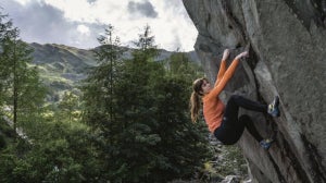
Mountain Tracks Guide Olly gives us an insight into some of the best routes at Chamonix Valley
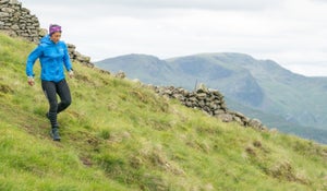
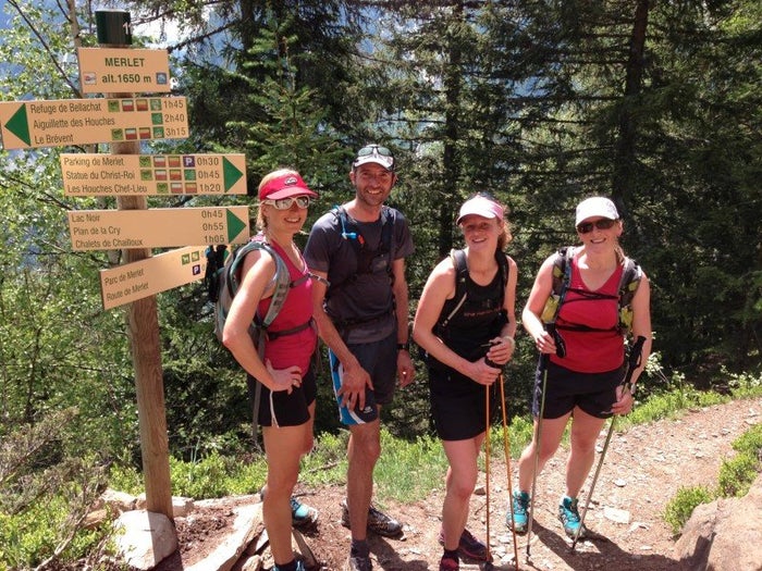
Hike 1 – Chamonix – Le Gailland – Bel Lachat – Aiguillette Les Houches – Chalets Chailloux – Parc Merlet – Chamonix.Start by leaving Chamonix in the direction of Les Houches on the Routes des Gaillands, pick up the hiking trail by the Lac des Gaillands on the rightside of the road and continue until you see the first sign to Petit Balcon Sud, to the right. Follow this climbing through the forest, bear left and continue to climb following the signs for the Refuge de Bal Lachat at 2136m. It’s a big climb of 1000m straight up with plenty of switch backs and as you gain height enjoy the great views across the valley to Mont Blanc and its glaciers. On reaching the refuge, stop in for a refreshing drink and a leg rest. The terrace outside the refuge, seemingly suspended over the steep mountain (which you have just ascended) is a perfect location for some stunning photos to be taken. On leaving the refuge take the trail to your right and it curves up and round to the Col de Bel Lachat, you will cross a large grassy area with great views to the Rochers des Fiz, with their vertical limestone cliffs they make a great backdrop to the next section of your walk.
From here the path climbs gently towards the far point in the distance, the Aiguillette Les Houches at 2285m, you will reach a couple of small cairns and finally a sign post to mark your arrival at the highest point of you walk. Take in the 360 deg panorama of the Mont Blanc massif and its glaciers the tranquil slopes of the nature reserve to the right and far distance valley of Sallanches with its lakes, fields and houses far below you.
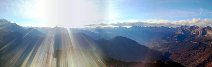
Start Point: Chamonix CentreFinish Point: Chamonix CentreHighpoint: Aiguillette Les Houches 2285mAltitude Gain: 1250mMaps: IGN 3530ET Samoëns and 3630 OT Chamonix Massif du Mont BlancTime: Allow 6-8hrs for the round tripGrade/difficulties: The paths are all good and well signposted. Expect some steep climbs and descents, snow can lie well into the summer on the crossing from Bal Lachet to the Aiguillette.Transport: You can catch the bus or train to the Lac de Gaillands from Chamonix centre. Get off the bus at the Arrêt Les Gaillands or the train at the Les Pelerins stop.Tip: This route can be shortened by starting and finishing at one of the car parks close to Parc Merlet. Be sure to take in the whole 360 deg panorama from the summit of the Aiguillette its one of the best places to see the Bossons and Taconnaz glaciers across the valley and also look down into the green valley’s so far below you.
Starting in Chamonix head towards the Planards and the start of the Montenvers Cog Railway, sign posted from town and across the railway line from the main Chamonix train station. Cross the main road and walk up towards the Les Planards ski slope, chairlift and children play area. You want to walk up the steep ski piste and bear left under the luge, follow the wide track in the forest sign posted for Montenvers par le Chemin Sortie Vallée Blanche. This will wind its way up hill, gaining height steadily through the beautiful pine, larch and silver birch forest. Stay on this wide track until you reach a small wooden building called the Cabane des Mottets at about 1650m. The trail you have just walked up is used by skiers in the winter to descend back to Chamonix having skied the famous Vallée Blanche ski run, more commonly known in Chamonix as the “James Bond Track”!
Take a rest here and enjoy the view across the bottom of the Mer du Glace gorge and up to the striking mountain of Les Drus. The waterfalls on the far side of the gorge are usually in full flow in the summer months too. Follow the sign for Montenvers, the path will now be marked by red and yellow paint spots on the rocks, you will have to climb 2 or 3 short metal ladders between the big glacial boulders on this section. Don’t worry they are easy to negotiate and don’t harbour a big drop beneath them! Soon enough you will arrive at the Montenvers Hotel building and top of the cog railway at 1909m.
You can take a drink on the sunny terrace of the hotel or at the cafe at the train stop. Make sure you enjoy the view of the magnificent Mer du Glace far below you and up towards the Grands Jorasses mountain. It’s worth visiting the 2 free exhibits close to the main hotel building the Galerie des Cristaux and the Glaciorium to see the amazing crystals found in the granite of the Mont Blanc massif and how the glaciers have changed over the years in the Chamonix Valley.
Onwards after this, take the path signed for Signal Forbes which climbs to 2198m and is well worth the effort for the extended views of the glacier and the Chamonix Aiguilles as you climb. Normally the flowers and the alpine rhododendron are in bloom in early summer and offer a beautiful splash of colour. At Signal Fordes you must turn around and admire the might of the mountain des Dru as it stands boldly above the Mer du Glace. Following the path in the direction of the Plan d’Aiguille you have a steady descent before reaching the main Grand Balcon Nord trail. Continue along the Grand Balcon Nord trail which curves and undulates its way along the mountain towards the Refuge Plan d’Aiguille. On reaching the refuge at 2233m it’s a must to stop for a rest and a drink and slice of Tarte aux Myrtilles on their sunny terrace to rejuvenate you before heaving you heavy legs up for the last time for the last short climb to the lift station above at 2310m. Descend to Chamonix by the cable car and it’s a short walk back into the centre of town.
Start Point: Chamonix CentreFinish Point: Chamonix CentreHighpoint: Plan d’Aiguille 2310mAltitude Gain: 1275mMaps: IGN 3630 OT Chamonix Massif du Mont BlancTime: Allow 7-8hrs for the round tripGrade/difficulties: The paths are all good and well signposted. If done in the early summer expect to encounter snow on Signal Forbes and the Grand Balcon Nord.Transport: If required you can travel to Chamonix centre by the local bus service and train, get off the bus at the Montenvers – Mer du Glace stop or Chamonix centre for the train.Tip: This route can be shortened by just taking the Grand Balcon Nord path direct from Montenvers to Plan d’Aiguille. Don’t forget to look for the semi-circular light and dark coloured bands in the ice of the Mer du Glace which James Forbes first described in the 19th century from the Signal Forbes, his view point for his glacial studies.
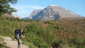
Hike 3 – Le Tour – Refuge Albert Premier – Le TourStarting at Le Tour you have two choices, firstly to walk from the car park to the refuge and back or secondly to take one or both parts of the ski lift that can assist the uphill for you.
If you choose to walk the trail winds up the hill side to right of the ski piste and reaches the mid-station at Charamillon around 1900m, this is a steady 1hr climb. From Charamillon pass the chalets de Charamillon and continue to climb on the trail to right of the chair lift, trending right-handed towards the trail you see coming from the top of the chair lift. On joining this follow the path climbing steeply on the moraine wall of the glacier towards the refuge.
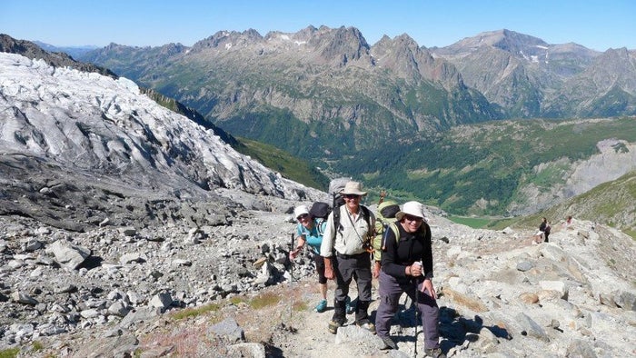
The retreating Glacier du Tour still provides a great spectacle to look at, its seracs and crevasses are close by and the view up to the mountains beyond of the Aiguille du Chardonnet, Argentiere and the Aiguille du Tour and breathtaking. Stop at the refuge for lunch where you can order omelettes, rosti and fried eggs, salad and sandwiches. It’s a popular trip with hikers and climbers and you will see lots of climbers heading up and down to climb the famous peaks around the refuge. Return via the same route either descending on foot to the valley or returning via the chair lift and gondola.
Start Point: Le Tour VillageFinish Point: Le Tour VillageHighpoint: Refuge Albert Premier 2702mAltitude Gain: 1250m from the village of Le Tour or 600m from the top of the chairliftMaps: IGN 3630 OT Chamonix Massif du Mont BlancTime: Allow 6-8hrs for the round trip from the village and 4-5hrs if you take the liftsGrade/difficulties: The paths are all good and well signposted. If done in the early summer expect to encounter snow on the climb toward the refuge. Usually there would be a good path in the snow due to the popularity of the route.Transport: Take the Chamonix Bus to Le Tour or the train to Montroc and walk up the road to the village of Le Tour.Tip: There is a path that goes from the Vormaine slope adjacent to the Le Tour ski area, cross the wide grassy slope by the drag lifts and head for the steep moraine wall descending on the rightside of the Glacier du Tour. The path climbs steeply here and continues straight up to the refuge. You can make a circular route by going up this way and back down via the route described above.Useful Links:
• Chamonix Valley information • Chamonix Valley Transport information • Mountain Guides for ski touring: • Hiking and Trail Running Guides:
Accommodation in Chamonix:• Comfortable, friendly chalet great in summer or winter • 3* hotel in Argentiere, comfy rooms and great location • 3* hotel in Les Praz great in the summer for hiking and trail running, good restaurant